 Itineraries
Agadir to Foum El Oued via Tiznit, Guelmim, Sidi Ifni · 15-day itinerary
Travel from Agadir to Foum El Oued, visiting Tiznit, Guelmim, Sidi Ifni, Smara, Assa, Tan Tan, Akhfennir, Khnifiss Lagoon RN1 Access, Tarfaya, Boujdour and Laayoune. 13 stops across 15 days.
a beach with a hill in the background
Along your itinerary
Places you’ll discover
This itinerary includes a full story and ordered stops. Check access, timetables and closures again before travel.
Road itinerary
Road itinerary distance and travel time are available for the full stop sequence.
Open a day to read its visits, practical details and travel connections.
Before you go
Get to know the places on your itinerary
Read what makes each place worth a visit and choose how you want to spend your time there. The stop sequence above keeps your day assignments; these guides help you shape the visits.
Stop 1
Agadir
a beach with a hill in the background
Use Agadir for an Atlantic stay with city visits, markets and carefully chosen surf or inland outings. Compare the seafront, your accommodation and actual activity meeting points before planning each day.
Choose how you want to spend an Atlantic stay
Agadir works well when you decide what should lead the trip: beach time, a comfortable urban stay, markets, surf lessons or a combination of coastal and inland visits. The seafront and the rest of the city offer different experiences. Choose accommodation by its exact location and the trips you expect to make, rather than by the city name alone.
Leave some days with a single focus. A market visit and an unhurried meal can fill an outing without needing another distant attraction. A beach day does not have to include a full regional tour. That flexibility is particularly useful for families or groups whose interests and energy levels differ.
Let the Souss appear in the city visit
Souk El Had introduces the city through food and everyday shopping: fruit, spices, clothing and household goods share the market with craft products. Choose an interest before entering, then let that guide your questions. Looking at ingredients for a meal gives a food walk a different purpose from searching for leatherwork or a metal object.
The wider Souss is associated with argan production and with jewellery traditions around places such as Tiznit and Taroudant. For an argan visit, ask to understand the production stages and distinguish an oil intended for cooking from a cosmetic product. In a jewellery shop, discuss material, workmanship and origin directly. These are useful subjects for a visit without assuming that every shop offers a demonstration or that every cooperative is open to unannounced groups.
See the market as part of the city
Souk El Had offers an opportunity to explore shopping and everyday trade. Decide whether you want to browse, buy specific goods or join a guided visit that explains products and their use. Ask before photographing stallholders or entering working spaces, and agree any purchases directly.
Food and ingredient pages can help you recognise something you want to try or understand. They are an introduction to culinary traditions, rather than evidence that a particular stall or restaurant has the item available. Ask about preparation and ingredients, especially when dietary requirements affect your choice.

In Souss-Massa, Tiznit connects craft and food.
A sense of place
Tiznit is a southern craft city known especially for silver, but its role is wider. It links Agadir, Aglou, Mirleft, Legzira, Tafraoute and Anti-Atlas routes. Important distinctions include its medina, walls, silver souk, craft verification, local food, coastal access and position as a gateway to deeper Souss and Guelmim routes.
The most useful regional connection is through Tiznit, which places the experience within Agadir’s coast, surf villages, argan country and Anti-Atlas gateways.
The local rhythm is visible in silver and walled city, silver souk, and medina walls.

In Guelmim-Oued Noun, Guelmim connects south gateway and food.
A sense of place
Guelmim is a gateway to southern Morocco, linking camel-market memory, Tighmert oasis, Sidi Ifni, Fort Bou Jerif, Plage Blanche, Assa and Sahara-edge routes. It supports drivers, guesthouses, market guides, oasis routes and overland logistics.
For many visitors, Guelmim becomes a gateway, stopover or base for onward travel; the surrounding streets, roads and services then determine how long the stop deserves.
From Guelmim, the itinerary connects naturally to the broader pattern of Anti-Atlas foothills, Sahara-edge oases and wild southern Atlantic roads.
This combination gives Guelmim a clear role in the wider Moroccan itinerary.
A useful visit is built around south gateway and camel-market city, tighmert oasis, and desert-edge routes.
Stop 4
Sidi Ifni
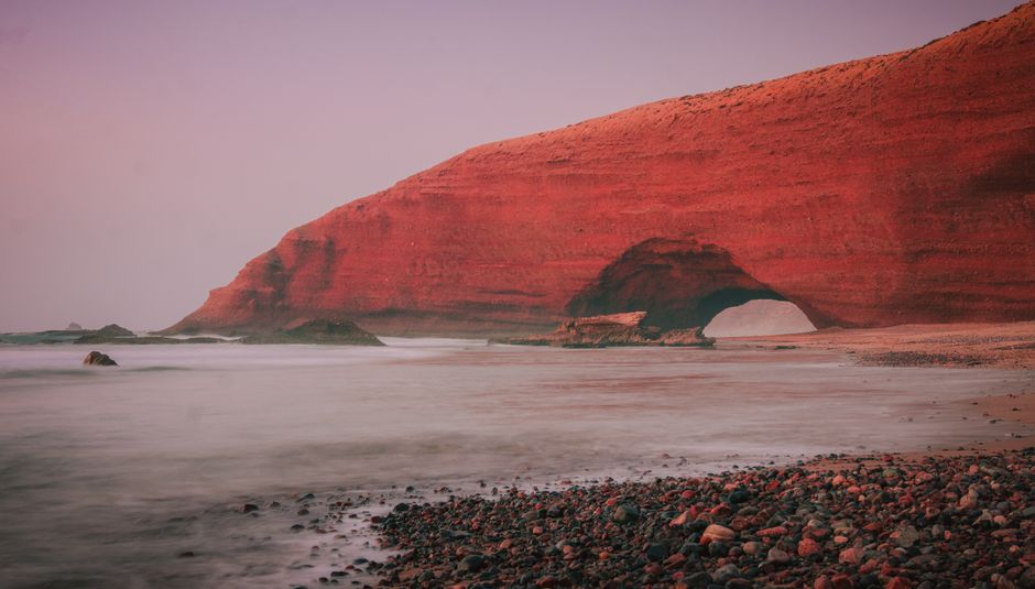
Stunning view of a large red rock arch on a misty beach during twilight, creating a serene atmosphere.
In Guelmim-Oued Noun, Sidi Ifni connects south coast and architecture.
A sense of place
Sidi Ifni is a southern Atlantic town with sea cliffs, Spanish-era architecture, blue-white urban details, cafés, fishing life, nearby beaches and access to Mirleft, Legzira and Guelmim routes. Sidi Ifni's value is atmosphere: it feels slower, more remote and more architectural than many coastal stops. Sidi Ifni connects naturally with Mirleft, Aglou, Legzira setting, Guelmim, Fort Bou Jerif and southern road trips.
Sidi Ifni adds a distinctive southern coastal identity.
The appeal of Sidi Ifni comes from the meeting of art deco Atlantic town, Atlantic cliffs, and spanish-era architecture, not from a single attraction.
From Sidi Ifni, the itinerary connects naturally to the broader pattern of Anti-Atlas foothills, Sahara-edge oases and wild southern Atlantic roads.
This combination gives Sidi Ifni a clear role in the wider Moroccan itinerary.
A useful visit is built around art deco Atlantic town, Atlantic cliffs, and spanish-era architecture.

In Laayoune-Sakia El Hamra, Smara connects inland Sahara and overland travel.
A sense of place
Smara gives the southern territory an inland Sahara dimension. Smara's value is not beach leisure; it is inland territory, road distance, Saharan identity and future route potential. Smara can support hotels, drivers, business/family movement, cultural setting, overland planning and future event or heritage interpretation.
Visitors need clear expectations around distance, heat, services and route purpose. Smara adds completeness and inland balance to southern coverage.
The appeal of Smara comes from the meeting of desert heritage town, desert routes, and heritage protocols, not from a single attraction.
For many visitors, Smara becomes a focused regional stop that connects local character with the surrounding itinerary; the surrounding streets, roads and services then determine how long the stop deserves.
Its position around Smara makes it easy to combine with the wider geography of Sahara-Atlantic cities, fishing ports, lagoons and long-distance coastal routes. The surrounding travel economy is carried by hotels, restaurants, private drivers, overland support teams, and guides, each serving a different stage of the visitor itinerary.
The experience gains depth through desert heritage town, desert routes, and heritage protocols, which can be explored at different speeds depending on the season, the traveler and the wider route.
Stop 6
Assa

Explore ancient desert architecture surrounded by lush palm trees under a clear blue sky.
In Guelmim-Oued Noun, Assa connects oasis and Sahara edge.
A sense of place
Assa is a Sahara-edge oasis town that helps connect Guelmim-Oued Noun with inland southern routes, palm-grove setting, cultural memory and long-distance movement.
Assa sits within Anti-Atlas foothills, Sahara-edge oases and wild southern Atlantic roads, and its identity is carried by oasis and ksar town, date palms, and remote roads.
For many visitors, Assa becomes a focused regional stop that connects local character with the surrounding itinerary; the surrounding streets, roads and services then determine how long the stop deserves.
From Assa, the itinerary connects naturally to the broader pattern of Anti-Atlas foothills, Sahara-edge oases and wild southern Atlantic roads.
That local balance gives Assa a purpose beyond simple map coverage.
The setting becomes easier to read through oasis and ksar town, date palms, and remote roads; each cue adds a practical or cultural reason to spend time here.
Stop 7
Tan-Tan

Expansive view of golden sand dunes under a clear sky in Tan-Tan, Morocco.
In Guelmim-Oued Noun, Tan-Tan connects sahara Atlantic and overland travel.
A sense of place
Tan-Tan is a Sahara-Atlantic gateway city linked to desert-edge culture, road logistics, coastal access, Tan-Tan Plage, Guelmim, Tarfaya and the long southern route. Tan-Tan is best understood as a route and cultural gateway. Tan-Tan’s role is operational, cultural and territorial.
Within Guelmim-Oued Noun, Tan-Tan is defined by saharan cultural gateway, oued Draa, and el ouatia, giving it a role that is different from the region’s better-known stops.
For many visitors, Tan-Tan becomes a coastal or waterside break within a wider route; the surrounding streets, roads and services then determine how long the stop deserves.
Tan-Tan gives the experience a clear place inside Anti-Atlas foothills, Sahara-edge oases and wild southern Atlantic roads, making onward planning easier.
A strong itinerary gives priority to saharan cultural gateway, oued Draa, and el ouatia, using the rest of the visit to support rather than distract from those defining qualities.
Stop 8
Akhfennir
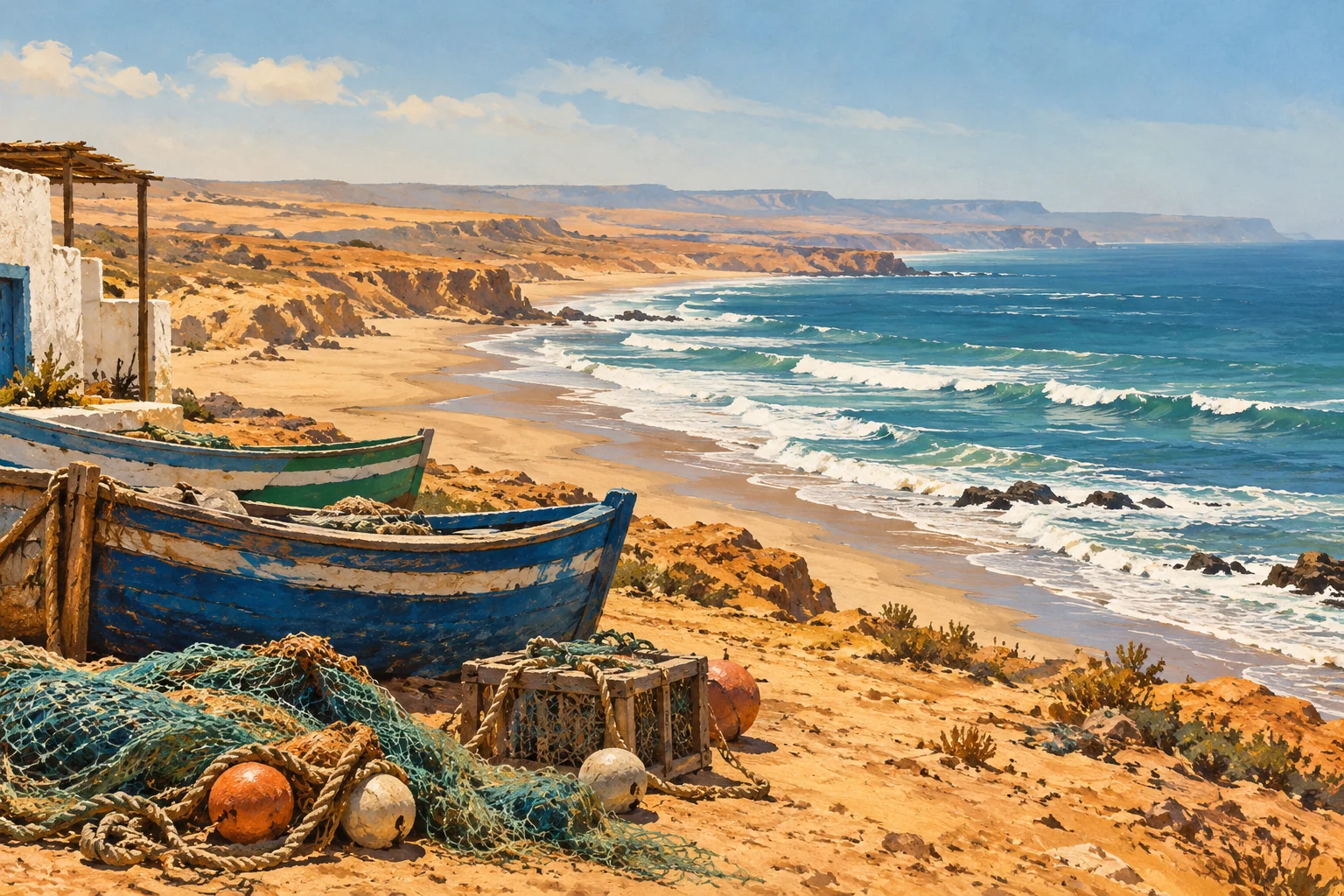
Editorial illustration of Atlantic coastal travel themes for Akhfennir.
Akhfennir is an Atlantic coastal settlement on Morocco's southbound road. Keep a town stop distinct from excursions to Khnifiss Lagoon or nearby cliffs. Check the actual destination and meeting point before organising a wildlife or coastal visit.
A coastal stop
Use the settlement's named location for orientation. A town stop does not guarantee public access to every cliff, fishing area or protected landscape nearby.
Wildlife and coast
The Khnifiss guide leads to a separate wetland subject. Confirm access and observation arrangements before including it in your itinerary.
Continue along the Atlantic
The regional guide connects Akhfennir with Tarfaya and other named destinations.
Stop 10
Tarfaya

The remains of the Casa Mar fortress built by the British in the 1880s in Tarfaya, Morocco.
Tarfaya links an Atlantic townscape with the history of early airmail. Antoine de Saint-Exupéry became station chief at Cap Juby, today’s Tarfaya, in 1927. That aviation connection gives a coastal stop here a story beyond the beach. Explore the town and shoreline, then check local arrangements for the Saint-Exupéry museum or memorial.
Tarfaya links an Atlantic townscape with the history of early airmail. Antoine de Saint-Exupéry became station chief at Cap Juby, today’s Tarfaya, in 1927. That aviation connection gives a coastal stop here a story beyond the beach.
Explore the town and shoreline, then check local arrangements for the Saint-Exupéry museum or memorial. Plan onward travel around confirmed road connections and current services. Allow time to appreciate the coast without assuming that a historic sea link still provides a passenger ferry.

In Laayoune-Sakia El Hamra, Boujdour connects fishing and southern route.
A sense of place
Boujdour is a southern Atlantic fishing and road-route town between Laayoune and Dakhla. Boujdour's value is in making the Dakhla route more legible.
Boujdour helps structure the southern Atlantic corridor.
Boujdour sits within Sahara-Atlantic cities, fishing ports, lagoons and long-distance coastal routes, and its identity is carried by Sahara Atlantic coastal town, lighthouse, and coastal road.
Its position around Boujdour makes it easy to combine with the wider geography of Sahara-Atlantic cities, fishing ports, lagoons and long-distance coastal routes.
The local rhythm is visible in Sahara Atlantic coastal town, lighthouse, and coastal road.

In Laayoune-Sakia El Hamra, Laayoune connects sahara and food.
A sense of place
Laayoune is a southern urban gateway connecting Foum El Oued, El Marsa, Smara, Tarfaya and the long Atlantic road toward Dakhla. Important distinctions include it as a practical regional base for business, coastal evenings, Sahara road trips and southern logistics.
Within Laayoune-Sakia El Hamra, Laayoune is defined by southern regional capital, regional services, and foum el oued, giving it a role that is different from the region’s better-known stops.
The most useful regional connection is through Laayoune, which places the experience within Sahara-Atlantic cities, fishing ports, lagoons and long-distance coastal routes.
The experience gains depth through southern regional capital, regional services, and foum el oued, which can be explored at different speeds depending on the season, the traveler and the wider route.
Stop 13
Foum El Oued

شاطئ مدينة فم الواد، التابعة لمدينة العيون، المغرب
In Laayoune-Sakia El Hamra, Foum El Oued connects beaches and laayoune access near Laayoune.
A sense of place
Foum El Oued is the coastal extension of Laayoune, giving the city access to beach, seafood, family outings, ocean views and southern Atlantic atmosphere.
Within Laayoune-Sakia El Hamra, Foum El Oued is defined by seafood and laayoune beach extension, giving it a role that is different from the region’s better-known stops.
Laayoune gives the experience a clear place inside Sahara-Atlantic cities, fishing ports, lagoons and long-distance coastal routes, making onward planning easier.
Together, these elements make Foum El Oued useful as both an individual stop and part of a larger itinerary.
Travelling between your stops
Compare the connections below when deciding where to stay and how much of each day to leave for visits. Driving estimates exclude traffic, breaks and time at attractions. Dated timetable references describe the collected services; check your travel date with the operator.
Agadir → Tiznit
Road · 92.8 km · 1 h 31 min
Estimated drive on the mapped road network. Travel time on site is additional.
Map and routing attributionTiznit → Guelmim
Road · 99.5 km · 1 h 9 min
Estimated drive on the mapped road network. Travel time on site is additional.
Map and routing attributionGuelmim → Sidi Ifni
Road · 54.9 km · 1 h 3 min
Estimated drive on the mapped road network. Travel time on site is additional.
Map and routing attributionSidi Ifni → Smara
Road · 411.3 km · 5 h 28 min
Estimated drive on the mapped road network. Travel time on site is additional.
Map and routing attributionSmara → Assa
Road · 463.5 km · 6 h 13 min
Estimated drive on the mapped road network. Travel time on site is additional.
Map and routing attributionAssa → Tan Tan
Road · 232.9 km · 3 h 24 min
Estimated drive on the mapped road network. Travel time on site is additional.
Map and routing attributionTan Tan → Akhfennir
Road · 112.4 km · 1 h 22 min
Estimated drive on the mapped road network. Travel time on site is additional.
Map and routing attributionAkhfennir → Khnifiss Lagoon RN1 Access
Road · 25.2 km · 19 min
Estimated drive on the mapped road network. Travel time on site is additional.
Map and routing attributionKhnifiss Lagoon RN1 Access → Tarfaya
Road · 84.6 km · 1 h 5 min
Estimated drive on the mapped road network. Travel time on site is additional.
Map and routing attributionTarfaya → Boujdour
Road · 277.7 km · 3 h 51 min
Estimated drive on the mapped road network. Travel time on site is additional.
Map and routing attributionBoujdour → Laayoune
Road · 188.0 km · 2 h 31 min
Estimated drive on the mapped road network. Travel time on site is additional.
Map and routing attributionLaayoune → Foum El Oued
Road · 22.0 km · 27 min
Estimated drive on the mapped road network. Travel time on site is additional.
Map and routing attribution
Make this itinerary yours
Add these stops to your current itinerary, then adjust the order and your travel preferences. This does not book transport, accommodation or activities.
Recheck transport, tickets, opening hours and access before travel.