Taza Thresholds and Tazekka Field Itinerary in Four Days
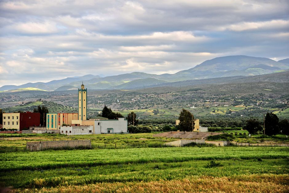
Picturesque landscape in Taza, Morocco featuring mosque and lush scenery.
Itinerary at a glance
This field itinerary links a strategic city to the mountain systems around it. Taza's gate, upper medina and Great Mosque setting establish why the gap between Rif and Middle Atlas mattered; Bab Boudir and the Tazekka landscape then replace urban masonry with forest, limestone and cave processes. Friouato is included as a conditional, professionally assessed stop—not a guaranteed descent—so the itinerary remains useful when access, weather or participant ability rule it out. The final return through Oued Amlil reads the transport corridor that still carries east-west movement. Designed for geography and heritage groups, the itinerary privileges observation logs, safe viewpoints and local expertise over collecting risky “hidden” locations.
Taza
This field itinerary links a strategic city to the mountain systems around it. Taza's gate, upper medina and Great Mosque setting establish why the gap between Rif and Middle Atlas mattered; Bab Boudir and the Tazekka landscape then replace urban masonry with forest, limestone and cave processes. Friouato is included as a conditional, professionally assessed stop—not a guaranteed descent—so the itinerary remains useful when access, weather or participant ability rule it out. The final return through Oued Amlil reads the transport corridor that still carries east-west movement. Designed for geography and heritage groups, the itinerary privileges observation logs, safe viewpoints and local expertise over collecting risky “hidden” locations. The practical visit is built around Bab er-Rih, Great Mosque exterior, Ras El Ma setting, Bab Boudir, Friouato cave access point, Oued Amlil.
- Bab er-Rih (20–75 min; mustdo): Read Taza's high defensive position and the landscape passage beyond the walls. The scoped visit works through gate masonry, weather-dependent outlook. The geography, geology, heritage field trip reading of Taza depends on giving Bab er-Rih its own time block. Cave and mountain access are conditional on official status, weather, equipment and qualified local supervision.
- Great Mosque exterior (20–75 min; optional): Place scholarship and worship at the center of the upper medina without assuming visitor entry. The scoped visit works through approach lane, medina wall segment. At Taza, Great Mosque exterior carries the road's geography, geology, heritage field trip focus. Cave and mountain access are conditional on official status, weather, equipment and qualified local supervision.
- Ras El Ma setting (20–75 min; optional): Introduce the water and relief that shape the city's southern edge; use only safe public access. The scoped visit works through spring-area overlook, watershed sketch. For the road's geography, geology, heritage field trip purpose, Ras El Ma setting is the working module at Taza. Cave and mountain access are conditional on official status, weather, equipment and qualified local supervision.
- Bab Boudir (20–75 min; optional): Enter the Tazekka park landscape through a recognized rural gateway. The scoped visit works through village orientation, forest edge. Place Bab Boudir inside the Taza sequence to support geography, geology, heritage field trip travelers. Cave and mountain access are conditional on official status, weather, equipment and qualified local supervision.
- Friouato cave access point (20–75 min; optional): Discuss karst and cave stewardship; descend only when officially open and professionally supported. The scoped visit works through surface geology, safety briefing point. For the road's geography, geology, heritage field trip purpose, Friouato cave access point is the working module at Taza. Cave and mountain access are conditional on official status, weather, equipment and qualified local supervision.
- Oued Amlil (20–75 min; optional): End at the A2 junction town that reconnects the mountain field area to the national corridor. The scoped visit works through authorized rest stop, road-map review. At this point in Taza, Oued Amlil advances the geography, geology, heritage field trip brief. Cave and mountain access are conditional on official status, weather, equipment and qualified local supervision.
Season and alternatives
Cave and mountain access are conditional on official status, weather, equipment and qualified local supervision.
Roads across Morocco
Places and roads
- Town or city
- Taza and Tazekka
- Region
- Fes-Meknes
Road map
Arrange this itinerary with a partner
No partner offers are attached yet.
If you offer an experience around Taza Thresholds and Tazekka Field Itinerary in Four Days, claim it in the partner portal.
Continue exploring
Taza and Tazekka · Fes-Meknes
- Fes Brass and Copper Workshop Visit
Fes Brass and Copper Workshop Visit focuses on small-group artisan demonstration with buying etiquette and workshop consent.
- Ain Leuh
Ain Leuh is a Middle Atlas forest and market town that can support quiet stays, cedar-country roads, local food and mountain-road itineraries beyond Ifrane and Azrou. Ain Leuh adds a distinct layer to Fes-Meknes: not only a point on the map, but a base, stop or local setting that changes how nearby itineraries are planned.
- Beni M'Tir AOG Wine
Beni M’Tir is a guaranteed-origin Moroccan wine appellation on the Meknes–El Hajeb plateau. The travel proposition is a licensed, adult-only comparison with neighboring Guerrouane and Coteaux de l’Atlas, using actual labels to explain appellation, vintage and producer choices.
- Fes Festival of Sufi Culture
Fes Festival of Sufi Culture is a spiritual culture festival recurring series based in Fes and connected to Fes-Meknes. The event is defined by Sufi thought, music, lectures, rituals and cultural dialogue in Fes.
- Finding a licensed guide in Fès
licensedguide
- Fes Craft Immersion in 5 Days
One city, multiple workshops and buyer-education blocks replace a rushed imperial circuit.